Spot BepiColombo during its goodbye flyby on April 9-10 – EarthSky
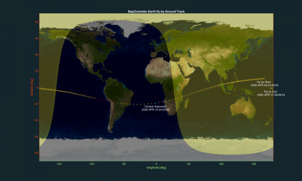
View larger. | “The flyby has an emotional effect,” said Johannes Benkhoff, BepiColombo’s Project Scientist. “It’s the last time that we can see the spacecraft from Earth, so we are inviting amateur and professional astronomers to observe it before it goes.” Compute your own plot of BepiColombo’s motion across your sky, by adding your latitude and longitude in this tool developed by a team of BepiColombo scientists from the National Institute for Astrophysics in Italy. Image via BepiColombo mission.
The European Space Agency (ESA) has announced that its spacecraft BepiColombo – launched from Earth in October 2018 on a roundabout journey to planet Mercury – will be visible to astronomers on the night of April 9-10, 2020. At the time, BepiColombo will be making its first and only Earth flyby, using Earth’s gravity to speed it up and alter its course slightly, then send it on its way toward its target planet in the inner solar system.
People in the Southern Hemisphere will have the best view of the spacecraft – through telescopes – as it passes relatively high in the sky. Meanwhile, observers as far south on Earth’s globe as the southern U.S. states of Florida and Texas might also catch the spacecraft, with telescopic aid, crossing lower in the night sky. ESA said:
By the time of the flyby, BepiColombo will have travelled almost 1.4 billion km [about 870 million miles] – roughly nine times the distance between Earth and the sun – since the European-Japanese mission was launched in October 2018. Yet, passing over at an altitude of just 12,700 km [about 8,000 mi], it will come within just a couple of thousand kilometers [1,300 mi] of our planet’s exosphere, the outermost layer of the atmosphere, providing us with the last chance to say hello – and goodbye.
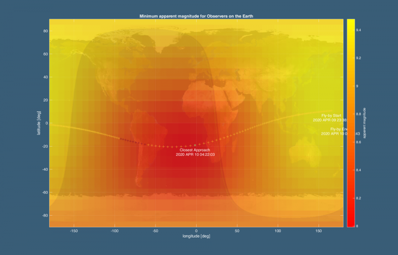
View larger. | This map shows BepiColombo’s visibility in the sky during the April 9-10, 2020, flyby for different locations on the planet. The spacecraft will not be visible to the unaided eye, but observers with small telescopes, binoculars or cameras might spot it. As indicated in the color bar on the right, red areas indicate the spacecraft’s apparent visual magnitude down to a value of 8 (too faint for the unaided human eye). The best places to spot the craft are in the Southern Hemisphere, but observers in southern locations of the Northern Hemisphere might also catch a parting glimpse. Compute your own plot of BepiColombo’s motion across your sky, by adding your latitude and longitude in this tool developed by a team of BepiColombo scientists from the National Institute for Astrophysics in Italy. Image via ESA.
BepiColombo is a joint mission of ESA and the Japan Aerospace Exploration Agency (JAXA). The April 9-10, 2020, flyby will be the first of a series of nine gravity assists that BepiColombo will use to reach its final destination, Mercury. It will arrive at Mercury in late 2025. ESA said:
The next two flybys will see BepiColombo proceed towards Venus in October 2020 and August 2021, respectively, followed by six flybys of Mercury itself to further adjust the trajectory. Eventually, the mission’s two science orbiters – ESA’s Mercury Planetary Orbiter and Mio, the Mercury Magnetospheric Orbiter of the Japan Aerospace Exploration Agency (JAXA) – will separate from the Mercury Transfer Module in late 2025 and start their scientific operations at Mercury in early 2026.
ESA said its mission scientists plan to use the flyby to test some of the instruments aboard the spacecraft, adding:
The operation, however, will be performed with limited personnel at ESA’s European Space Operations Centre (ESOC) in Darmstadt, Germany, where engineers will have to comply with social distancing rules presently in place all over Europe as a response to the coronavirus pandemic.
Elsa Montagnon, BepiColombo Spacecraft Operations Manager at ESA, added:
The Earth swing-by is a phase where we need daily contact with the spacecraft. This is something that we cannot postpone. The spacecraft will swing by Earth independently in any case.
Observing a relatively close object in the sky from different locations will produce a slight difference in the view from different parts of Earth. Thus the spacecraft will appear closer to or farther from a fixed star, as seen from different perspectives or countries. We have included some sample viewing charts to help you find the spacecraft moving in front of the stars (using binoculars or a small telescope). NOTE: The times given on these charts are local times, the time on your clock as seen from the various places mentioned in the charts. Eddie Irizarry, who created these charts for EarthSky, commented:
I double-checked these times for each country and also verified in Google the current time in each of these countries, to confirm if they are, or are not, using daylight time.
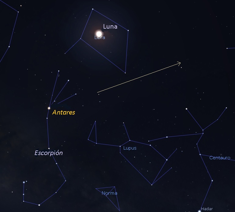
BepiColombo as seen from Bogota, Colombia. Facing south-southeast – 11:45 p.m. to 12:05 a.m.local time – on the night of April 9, 2020. Illustration by Eddie Irizarry using Stellarium.
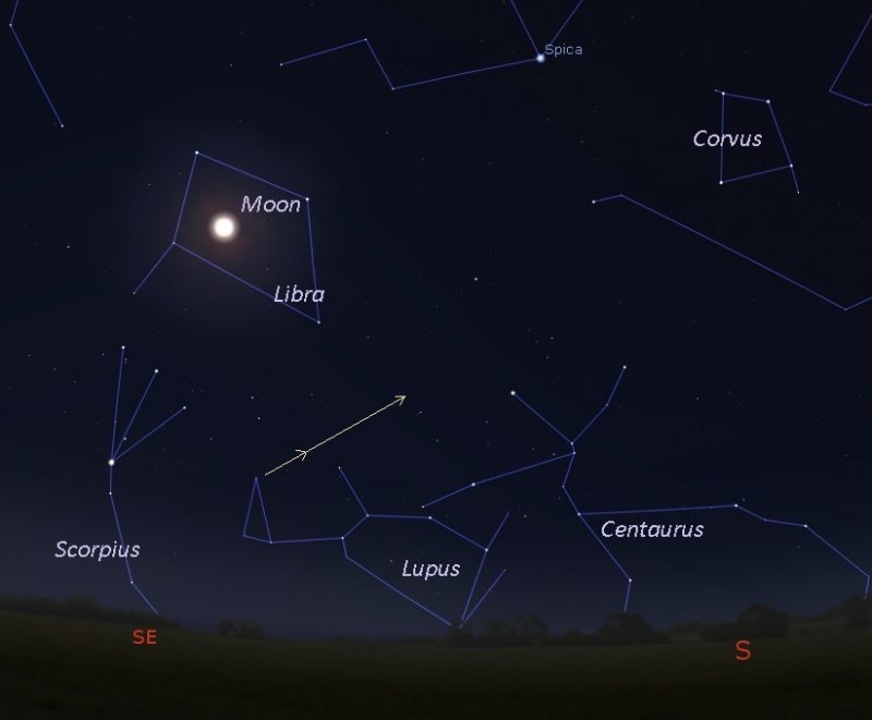
BepiColombo as seen from Florida – low on the southeastern horizon – 9 to 10 p.m. to 12:45 to 1:05 a.m. local time. Illustration by Eddie Irizarry using Stellarium.
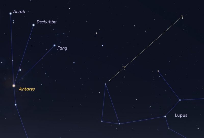
A closer view of BepiColombo as seen from Florida – low on the southeast horizon – from about 9 to 10 p.m. to 12:45 a.m. to 1:05 a.m. local time. Illustration by Eddie Irizarry using Stellarium.
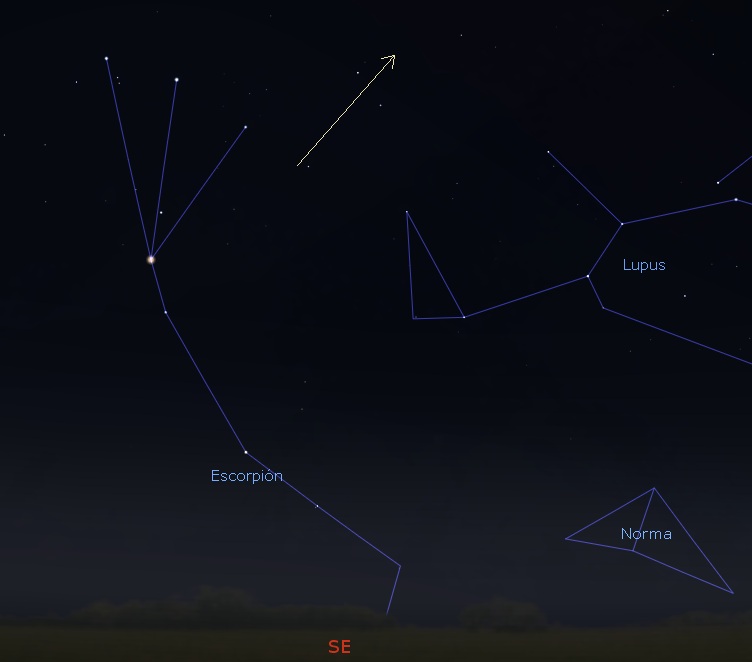
BepiColombo as seen from Mexico City – low on the southeastern horizon – 11:45 p.m. to 12:05 a.m. local time on the night of April 9. Illustration by Eddie Irizarry using Stellarium.
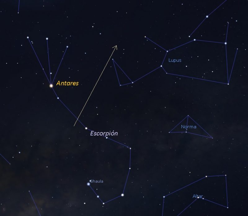
BepiColombo as seen from Santiago, Chile – 1:30 a.m. to 1:50 a.m. local time – on April 10. Illustration by Eddie Irizarry using Stellarium..
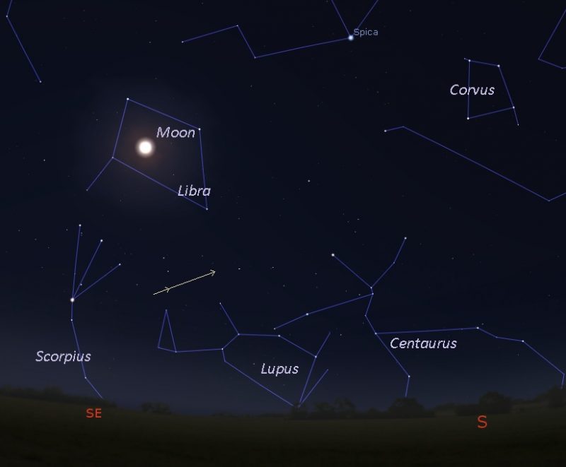
BepiColombo as seen from Texas – low on the southeast horizon – 11:45 p.m. to 12:05 a.m. local time on the night of April 9. Illustration by Eddie Irizarry using Stellarium.
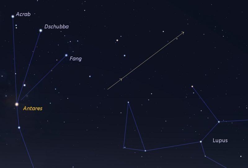
A closer view of BepiColombo as seen from Texas – low on the southeast horizon – 11:45 p.m. to 12:05 a.m. local time on the night of April 9-10. Illustration by Eddie Irizarry using Stellarium.
Bottom line: On the night of April 9-10, 2020, BepiColombo will pass 7,891 miles (12,700 km, about 1 Earth diameter) from Earth’s surface. For most of us, it’ll pass unseen. But people with telescopes will spot it! How to spot BepiColombo on its roundabout journey to Mercury – charts and more – here.


